


Points of Interest:
- Look for a wide variety of plants rare in Missouri that are more common to the southeast U.S.
- See unique remnant forest, woodland and acid seep communities of Crowley’s Ridge.
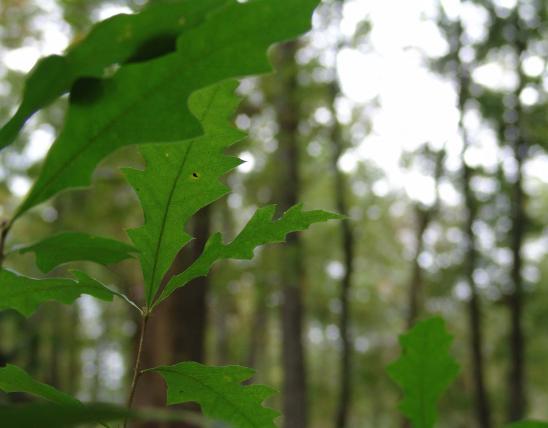
- Enjoy forests of American beech, American holly, and tulip poplar.
Natural Features:
This area lies on Crowley’s Ridge, a long ridge that rises 100–250 feet above the surrounding Mississippi Lowlands. This ridge is an erosional remnant that has had the Mississippi River historically flow on both sides of it in the past that reduced it to its present size. The ridge is formed of bedrock at its core that is overlain with gravels and sands. A cap of wind-deposited loess soils occurs in places. The forests and woodlands here are more similar to those found in nearby Arkansas and western Tennessee than the Ozark woods to the west.
The acidic seeps here are formed from the percolation of groundwater through sands and gravels. Along the seeps are many sedges and ferns. Over a dozen rare plant species are found on the natural area. The seepage fed creeks support a population of the goldstripe darter, a species of conservation concern. Plants such as American holly, Virginia willow, beech drops, and black chokeberry found here are more typical in the southeast U.S.
This natural area is within Holly Ridge Conservation Area. From the intersection of Highways 25 and 60 near Dexter travel east on Highway 60 for 2.5 miles. Turn left (north) onto County Road 531 and go 0.6 miles and turn left (west) onto County Road 570. Travel west on County Road 570 for about a half mile and then turn right (north) onto County Road 527. Travel north on County Road 527 to the railroad tracks. After crossing the tracks continue north on County Road 527 for about a half mile. The parking lot will be on the left (east) side of the road (lot F). An area access road provides a hiking trail into the natural area. A map and compass are recommended to explore the area. Hunting is permitted. Please avoid walking through the fragile acid seep natural communities that have easily damaged saturated (mucky) soils.
MO
United States