


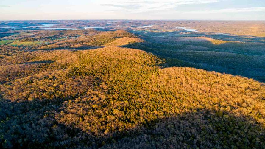
Pilot Knob Conservation Area
Navigating nature along the trail
With technology, we can all go into the outdoors with any number of tools to keep us from getting lost — GPS, online maps, satellite phones. Pilot Knob Conservation Area (CA) reminds visitors of how people navigated nature before today’s high-tech age.
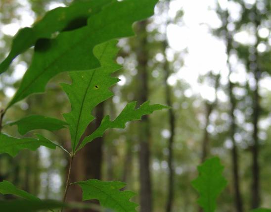
Located on 1,360 acres in southwest Missouri’s Stone County, Pilot Knob CA takes its name from an old-school technique of navigating one’s way, using tall hills — or “knobs” — as reference points to determine your location. In some cases, the tops of these hills were cleared of all but one “signal” tree, making that hilltop a “pilot knob.”
Because of Pilot Knob CA’s 6.6-mile out-and-back hiking trail, neither advanced technology nor historic outdoor skills are required (but your regular day hiking gear like maps, water, and phone are highly recommended). Starting at the area’s parking lot on its western edge along Hwy. 39, the area’s trail is considered moderately difficult by many users.
The mostly forested area is located between the National Audubon Society’s Shell Knob Glades and Woodlands and White River Glades and Woodlands important bird areas, making it a birding destination for spring woodland and glade species.
And More...
This Issue's Staff
Editor - Angie Daly Morfeld
Associate Editor - Larry Archer
Photography Editor - Cliff White
Staff Writer - Kristie Hilgedick
Staff Writer - Joe Jerek
Staff Writer – Dianne Van Dien
Designer - Shawn Carey
Designer - Marci Porter
Photographer - Noppadol Paothong
Photographer - David Stonner
Circulation – Marcia Hale