Body
Kansas City, Mo. – Maps developed by the 1804-1806 Lewis and Clark Expedition provided a new nation with its first scientific look at the geography and natural resources of the northern Great Plains and Rocky Mountains. Meriwether Lewis and William Clark accomplished their mapping with simple tools and the science of the day. The Missouri Department of Conservation (MDC) is hosting a special display of the expedition’s maps and their influence at the Anita B. Gorman Discovery Center, 4750 Troost Ave., in Kansas City. The free display is open for viewing and will be in place through Oct. 8 in partnership with the Lewis and Clark Trail Heritage Foundation.
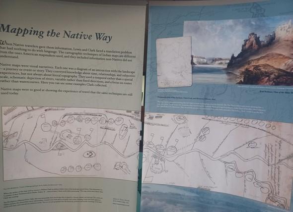
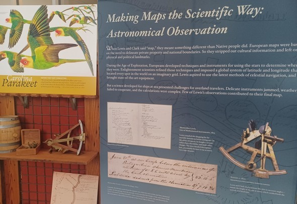
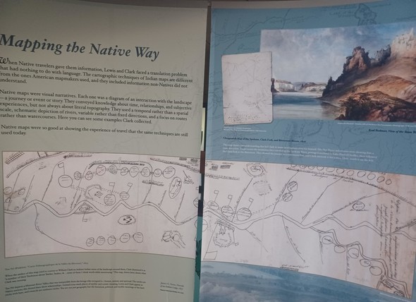
The exhibit, entitled Reimagining America: The Maps of Lewis and Clark, explains how the expedition’s findings transformed Euro-American understandings of North America in the early 1800s. It also investigates methods used by the explorers to gather and process that information, including preexisting maps, navigational scientific equipment that was considered cutting edge for its time, and intelligence gained from Native Americans whom the explorers interacted with.
MDC’s Gorman Discovery Center is named in honor of the Corps of Discovery, the name for the expedition, which traveled on the Missouri River through what’s now Kansas City. The Corps camped in what’s now the metro area’s heart during both the 1804 upstream and 1806 downstream journeys. Discovery Center visitors will also find permanent MDC exhibits related to the Lewis and Clark Expedition.
For more information about the Gorman Discovery Center, call 816-759-7300, or visit https://mdc.mo.gov/discoverycenter. To learn more about the Lewis and Clark Trail Heritage Foundation, visit lewisandclark.org.